 +86-13981905144
 inquiry@chinaroadtrip.org
Road, weather and vehicle tips for Tibet’s main routes
Written by China Road Trip | Updated 2026-9-11

When people research Tibet road conditions, they usually start with one question: is the road paved? On many of the main travel corridors into Tibet, the core roads are surfaced for much of the journey. But for anyone planning a self-drive trip or motorcycle journey, “paved” tells only part of the story.
The real difficulty of a Tibet route is shaped by altitude, weather, mountain passes and switchbacks, the distance between towns and fuel stations, temporary roadworks or travel controls, and the realistic daily distance once altitude fatigue is taken into account. This guide compares the road conditions and driving experience across the Sichuan-Tibet highways, the Yunnan-Tibet corridor, the Qinghai-Tibet highway, the Xinjiang-Tibet routes, and the Nepal-Tibet corridor through Gyirong.
It is a route-planning reference rather than a real-time road bulletin. Road, weather and border conditions should always be reconfirmed close to departure.
Tibet Road Conditions at a Glance
The table below gives a quick comparison of the routes covered in this guide. The same destination can feel very different depending on the road, season and vehicle you choose.
| Route | Main Character | Typical Challenge | Best For |
| G318 | Classic Sichuan-Tibet mountain route | Passes,curves and rain-season disruption | First classic overland journey |
| G317 | Northern Sichuan-Tibet alternative | More remote services and longer planning margins | A quieter northern route |
| G214 + G318 | Yunnan-Tibet approach | Mountain driving and a long cumulative distance | A more gradual approach to altitude |
| G109 | Qinghai-Tibet plateau highway | Wind, cold and sustained elevation | Plateau-road experience |
| G216 | Remote Xinjiang-Tibet route | Variable terrain and logistics | Experienced off-road travelers |
| G219 | Western Tibet long-distance route | Extreme altitude and long resupply gaps | Experienced overlanders with more time |
| Gyirong / Nepal-Tibet | Cross-border moutain corridor | Weather-sensitive valley access and border coordination | Nepal-Tibet extensions |
Sichuan-Tibet Road Conditions: G318 and G317
G318: The Classic Chengdu-Lhasa Route
The G318 is the best-known overland route into Tibet. It is largely paved along the Chengdu-Lhasa travel corridor, but its challenge is not simply the road surface. The route crosses a long sequence of high mountain passes and extended switchbacks, so daily progress is measured less in kilometres than in hours of focused mountain driving.
 |
In the wetter months, especially on steep river-valley sections of western Sichuan, rain can bring rockfall, landslides, fog and temporary delays. Temperatures can also change sharply between lower valleys and high passes. The G318 remains a strong choice for a first Tibet road trip, provided the itinerary allows sensible daily distances and flexibility for weather.
G317: The Northern Sichuan-Tibet Alternative
The G317 follows a more northerly line than the G318 and offers a different rhythm of travel: high plateau and grassland landscapes, mountain sections and Tibetan cultural areas in the Kham region. It should not be treated as simply another name for the G318.
 |
Road conditions and services can vary more by section and season than on the main G318 corridor. Travelers choosing G317 should allow wider planning margins for fuel, lodging and route changes. It suits people who want a quieter northern alternative and are comfortable with a more self-reliant journey.
Yunnan-Tibet Road Conditions: G214 to G318
From Kunming Through Yunnan
The Yunnan-Tibet route via G214 offers a different approach to Tibet. Starting from Kunming, it passes through northwest Yunnan, where the landscape shifts from lower valleys to alpine terrain. The road is mountainous, with continuous curves, climbs and descents, so weather and elevation shape the driving experience more than they would on a flat highway.
 |
For many travelers, the attraction is the gradual gain in altitude before the highest Tibetan sections. It is a scenic and logical route for travelers beginning in Yunnan, but it still needs realistic daily stages rather than highway-style distance planning.
After Markam: Joining G318 to Lhasa
G214 does not continue independently all the way to Lhasa. After Markam, the route joins G318, bringing the same higher passes, greater altitude exposure and mountain-driving demands found on the Sichuan-Tibet corridor. The Yunnan approach is therefore a more gradual entry to altitude, not a route without high-altitude driving.
Qinghai-Tibet Road Conditions: G109
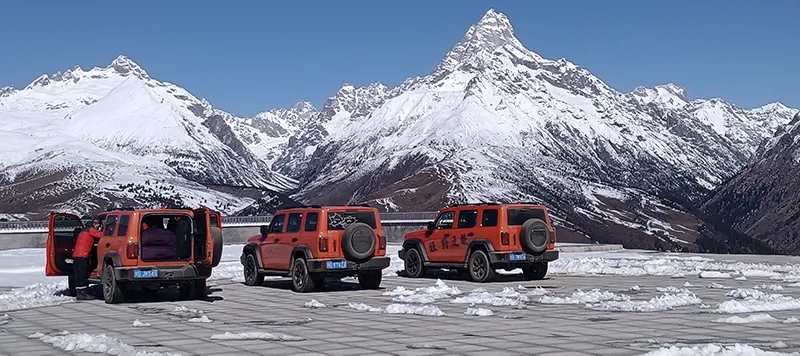
G109, the Qinghai-Tibet highway corridor from Xining toward Lhasa, feels very different from the Sichuan and Yunnan routes. Instead of continuous mountain switchbacks and valley terrain, it is defined by long, open stretches of high plateau.
 |
Its challenge is endurance rather than technical cornering. Strong winds, cold conditions, sustained elevation and long exposed sections can create fatigue, particularly for motorcyclists. Some stretches require careful fuel and timing planning. Compared with G318, G109 trades repeated curves for a longer and more sustained high-altitude driving experience.
Xinjiang-Tibet Road Conditions: G216 and G219
G216: Remote and Off-Road-Oriented Travel
G216 sits at the more demanding end of the spectrum. Its Xinjiang-Tibet itinerary is defined by remoteness, large changes in terrain and longer distances between practical support points. Road conditions can vary more across such a long remote route than on the established eastern corridors.
 |
Vehicle preparation, logistics and a realistic plan for delays matter more here than on G318 or G109. This is not a casual add-on to an ordinary Tibet road trip; it is better suited to travelers with relevant long-distance experience and organized support.
G219: The Western Tibet Long-Distance Route
G219 is closely associated with western Tibet and the Ali region. Its defining challenge is sustained distance at very high elevation. Depending on the planned section, services and resupply can be widely spaced, and the timetable needs room for weather, altitude and the fact that map distance takes longer to cover on the plateau.
 |
G216 and G219 are often grouped together as Xinjiang-Tibet routes, but they are not interchangeable. G216 is shaped more by terrain variety and remoteness; G219 is shaped more by long-distance endurance at high altitude. The right choice depends on the kind of journey a traveler is prepared to support.
Nepal-Tibet Road Conditions: Gyirong and Everest Extensions
The Gyirong corridor is one of the main routes used for Nepal-Tibet itineraries when road access and border arrangements permit. Its valley terrain is more weather-sensitive than Tibet’s open plateau routes. Rain in the lower valley sections can affect access more quickly than it does on the drier plateau roads further east or north.
 |
For travelers continuing toward Everest, the journey shifts again toward high-altitude exposure, colder conditions and mountain switchbacks. A Nepal-Tibet trip through Gyirong should be planned as one connected route, with road access, border arrangements and vehicle logistics considered together. Current road and border status must be confirmed close to departure.
Road Conditions on Common Tibet Travel Legs
The routes into Tibet are only part of the decision. Once travelers reach Lhasa, the roads to major destinations have their own driving character. These internal travel legs are generally more established than the remote western routes, but they still need to be planned around altitude, weather and realistic daily driving time.
Lhasa to Nyingchi
 |
The Lhasa-Nyingchi corridor is one of the smoother and more accessible travel legs in Tibet, with a major road connection between the two cities. It is often a comfortable choice for travelers who want to begin with a lower-intensity road day after arriving in Lhasa. That does not remove the need to pace the trip: weather can change around the mountain sections, and drivers should still allow time for stops, elevation changes and local traffic conditions rather than treating it as an ordinary urban expressway.
Lhasa to Yamdrok Lake, Gyantse and Shigatse
 |
This classic southwestern circuit combines well-maintained main roads with high passes, lake-side viewpoints and mountain curves. The driving is scenic rather than technically extreme, but wind, changing weather and photo stops make the day longer than its map distance suggests. It works well as an extension from Lhasa for travelers who want a balanced introduction to plateau driving before continuing toward Everest or western Tibet.
Shigatse to Tingri and Everest Base Camp
 |
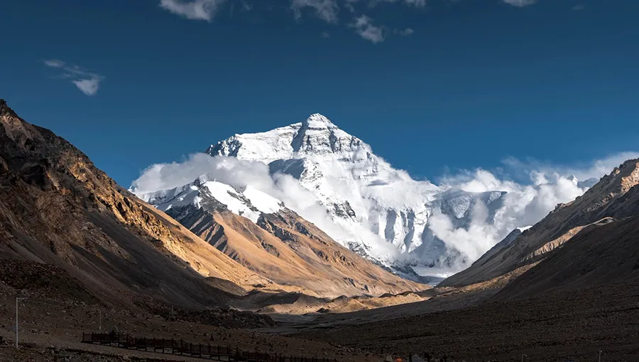
The Everest approach is not mainly difficult because of poor pavement. Its character comes from rising elevation, exposed weather, wide plateau landscapes and the final mountain-road sections toward the Everest area. Wind and visibility can matter as much as road surface, especially outside the warmest part of the day. Plan this leg with an early start and enough time to avoid turning a high-altitude sightseeing day into a rushed drive.
Lhasa to Namtso
 |
The Namtso direction is an open, high-altitude journey rather than a continuous mountain-road challenge. The main issues are exposure, wind, cold and the way elevation can affect stamina during a long day. Conditions can be more restrictive in winter, so this route should be chosen according to the season and reconfirmed shortly before travel.
Lhasa to Ngari and the Ali Region
 |
Road trips toward Ngari and Ali are defined by distance and sustained altitude. Even where the road surface is serviceable, the journey requires more conservative daily stages, dependable fuel planning and flexibility for weather. This is the point at which an ordinary Tibet road trip becomes a longer western-Tibet expedition, so travelers should not simply add it to a short Lhasa itinerary.
Seasonal Guide to Tibet Road Conditions
| Period | Typical Conditions | Planning Focus |
| May-June | Generally stable travel window; mountain weather still varies | G318, G214, G109 and common Lhasa extensions |
| July-August | Wetter mountain approaches; rain can cause route delays | Travel with flexibility and reconfirm mountain sections |
| September-October | Often favorable for self-drive and motorcycle travel | G318, G214, Everest and longer western routes |
| November-March | Cold conditions, snow and ice possible on high passes | Choose by current weather and route access, not season alone |
 |
Seasonal patterns are useful for choosing a route, but they are not a substitute for a final road and weather check. Conditions vary by altitude and corridor, so a route that is suitable in one part of Tibet may be less practical on a high pass or in a rain-affected valley on the same dates.
What Can Change Road Conditions on Every Tibet Route
Rainy-Season Landslides and Mudslides
July and August are typically the wettest months on many mountain approaches, although rainfall patterns vary by corridor. In Sichuan, Yunnan and the Gyirong valley, heavy rain can bring rockfall, mudslides, temporary closures or single-lane traffic while debris is cleared.
Winter Ice, Snow and Pass Closures
Winter conditions vary widely, but high passes can bring snow and ice that slow travel or lead to temporary closures. Winter itineraries need suitable equipment where local conditions require it, flexible timing and a willingness to wait rather than press on in unsafe conditions.
 |
Roadworks, Travel Checks and Real Driving Time
Road maintenance and improvement projects are common, while temporary road controls and routine travel checks can add time to a day. Map distance rarely matches actual driving time once slow mountain sections, stops and weather are included.
Altitude Fatigue and Driving Judgment
Sustained time at high altitude can affect concentration and driving stamina, even when a traveler feels generally well. On routes such as G109 and G219, elevation remains high for extended periods, so rest, hydration and conservative daily stages matter as much as the road itself.
How to Plan for Tibet Road Conditions
Build the Itinerary Around Daylight, Not Map Distance
On mountain and plateau routes, a short-looking distance can still take a full day once curves, passes, weather, meal stops and photography are included. Plan to arrive before dark, especially when the next accommodation is far away or the route crosses a high pass. A practical itinerary is one that can absorb a weather delay without forcing a driver or rider to rush.
Match the Vehicle to the Route and Season
A car offers better protection from rain, wind and cold on exposed plateau roads, while a motorcycle makes weather and surface changes more immediate. For longer or more remote itineraries, vehicle condition, tire suitability, luggage security and fuel range matter more than chasing a larger engine or a faster schedule. Travelers who do not bring their own vehicle can use locally arranged vehicles and support suited to the route.
Prepare for Weather and Altitude as One Issue
Weather affects more than comfort: wind, rain, low cloud and cold can slow driving and increase fatigue. Layered clothing, waterproof outer protection and warm gloves matter for riders; drivers should also keep warm layers and drinking water easy to reach. At altitude, a conservative first few days and regular rest stops support safer decisions on the road.
Confirm Fuel, Communications and Daily Support
Before leaving a larger town, confirm the next fuel stop, overnight point and contact method for the day. Remote routes do not always reward last-minute changes, and local support becomes especially valuable when weather, roadworks or a vehicle issue affects the original plan. This is practical route preparation, not a reason to overpack every possible item.
Car or Motorcycle: How the Same Route Feels Different
The same road can feel very different behind a windshield and on two wheels. A car gives passengers and luggage better protection from wind, rain and cold, and is generally more forgiving when weather changes quickly. A motorcycle gives a more direct riding experience, but wind, low temperatures, loose gravel and wet surfaces all affect grip, braking and fatigue more immediately.
G318 and the Yunnan approach are generally the more established options for first-time Tibet travelers, whether by car or motorcycle, because services and travel support are more readily available along the main corridors. G216 and G219 demand more from both vehicle and traveler, so reliable logistics are especially important.
How to Choose the Right Route for Your Trip
- For a classic scenic road trip: Choose G318 if you want the best-known Chengdu-Lhasa journey and are prepared for mountain passes, curves and variable weather.
- For a more gradual approach: Choose G214 through Yunnan before joining G318 if you want to gain altitude in stages and combine Yunnan scenery with Tibet.
- For open plateau driving: Choose G109 if the appeal is the Qinghai-Tibet plateau itself rather than continuous mountain driving.
- For remote western Tibet: Consider G216 or G219 only when you have enough time, suitable experience and dependable logistical support.
- For Nepal and Everest extensions: Plan the Gyirong direction as a flexible cross-border itinerary and reconfirm current road and border access before finalising the route.
FAQs
- Are Tibet’s main roads paved?
Many major travel corridors, including G318, G214 and G109, are paved for much of their length. Road surface alone, however, does not show the full picture: weather, mountain terrain, altitude and temporary works still affect the journey.
- Which Tibet route has the easiest road conditions?
No route into Tibet is entirely easy. G318 and the Yunnan approach via G214 are relatively more established for first-time travelers, but both still involve high passes, mountain weather and altitude exposure.
- Is G318 suitable for motorcycle riders?
Yes. G318 is one of the most popular Tibet motorcycle routes because it combines varied scenery with an established travel corridor. Riders should still prepare for continuous curves, high passes and changing weather.
- Is G109 easier than G318?
Not necessarily. G109 avoids many of G318’s repeated mountain switchbacks, but it brings sustained elevation, wind, cold and long exposed stretches. The two routes are demanding in different ways.
- Can road conditions change after an itinerary is confirmed?
Yes. Weather, seasonal landslide or snow risk, temporary roadworks and travel controls can all change access or daily driving time. Current conditions should be reconfirmed close to departure.
Conclusion
Choosing a route into Tibet should not come down to the shortest line on a map. G318, G317, G214, G109, G216, G219 and the Gyirong corridor each bring a different balance of terrain, altitude, weather exposure and logistical demand. The right choice depends on the season, vehicle, driving or riding experience, available time and the kind of journey you want.
Use this comparison as a starting point, then confirm route-specific road, weather and access arrangements before departure. If you are unsure which route best matches your travel dates, vehicle and driving experience, share your plan with us and we can help assess the itinerary around seasonal conditions and current access arrangements.
Ask a Quick Question & Free Enquiry

If you have a WhatsApp, please feel free to scan our WhatsApp code.